Not far up Route 191 is Arches National Park. When I left the campsite, I still wasn't sure if I was going to tour the park, but since I seemed to have missed my planned turn, I pulled into the parking lot and paid the fe
 e. The warming morning sun was enticing, and I'd gotten an early start; I'd still surely make the 3:00 Rockies-Cardinals game in Denver.
I drove the winding road to the end of the park, took a few snapshots and began my drive back out. When I came to the turnoff for the hike to Delicate Arch, I decided I could get in and out quickly with a few lovely pictures. (I know this isn't the way you are supposed to enjoy our national parks, but remember that I had considered passing by altogether, so these quick looks were a bonus in my mind. I'll be back another time to do it right.) I charged onto the trail and was soon passing couples on their way up to the arch. Somewhere in my rush, I missed a turn in the trail and so
 on found myself looking up at the crowd of people happily chatting and posing in front of the most photographed arch in the park. My picture came from an unsettling spot where I wasn't supposed to be, and the sunshine was on the wrong side for a good photo. After slowly edging my way
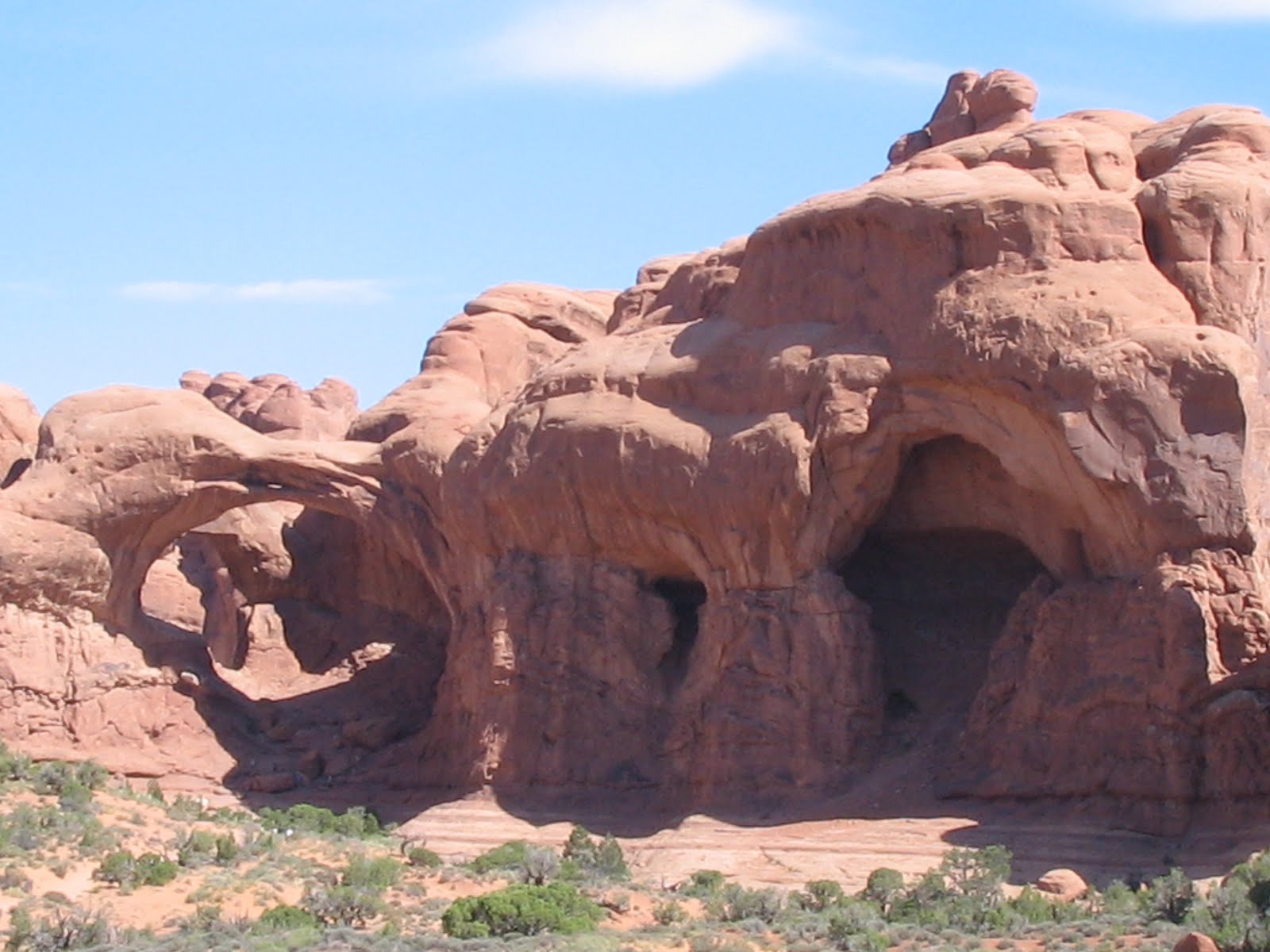 back to safety, I considered hiking around to where everybody else was, but I had already burned too much precious time getting lost. I found my way back to the path and half ran down to the car. After a little more driving to scenic viewing points, I headed for the exit and turned left to follow state road 128 up to I-70.
128 is a gem of a road that follows the C
 olorado River upstream past white water rafters bouncing through rapids. High canyon walls pushed right against the slithering ribbon of pavement. I actually previewed this route using Google Maps's "street view" feature, but the Google car's cameras substantially diminish what 128 has to offer. If you're ever in the neighborhood of Arches National Park, give her a try.
In hopes of making up lost time, I flew into Colorado on I-70. My calculations had me missing an inning or two of the game, but that was okay with me. I gassed up in Gr
 and Junction and then drove through what I judged to be an overhyped pass cut through the mountains by the Colorado River. I-70 from Denver to the Utah state line is supposed to be one of the two or three most scenic stretches of interstate in the country, but the walls along this portion looked pretty much like quarry detritus.
Just after Glenwood Springs, I-70 begins to fulfill expectations, but on this day she was also flirting with the dangerously sullen storm clouds that had gathered in front of
 me. I wound through narrow canyons looking alternately at the traffic in front of me, the walls around me, and the gathering darkness above me. This was going to slow me down.
The interstate began to climb steeply, and I had to repeatedly shift back into fourth gear to keep up with traffic. Raindrops started to splatter my windshield as I passed mile marker 175, and it was raining steadily by the time I crested the 10,666 foot high Vail Pass. Almost immediately after, I went from annoyed by the inconvenience of the rain and the further lateness it was going to cause me to fear that I was going to slide off the mountain.
After Vail Pass, the interstate dropped sharply as the rain picked up. Rivers of water ran down the blacktop in front of me, and I hydroplaned several times. I kept the car in fourth gear all the way down, slowing at times to just forty miles an hour. Tractor trailers raced past me, sending up a blinding spray, and cars came up on my bumper before swerving into the left lane to pass. I wasn't having any fun at all, but by the time the road bottomed out, the rain had backed off a bit, and I thought that the worst was behind me. Then we began to go up again at an even steeper incline, heading back into the clouds and the rain. At this point I had to shift through fourth gear and down to third just to keep my speed above 45. With streams of rainwater rushing toward me now, I hydroplaned again. Cautiously white-knuckling my way to the top of the climb, I breathed easier when the road flattened and dried out in the Loveland Pass tunnel. At an elevation of 11,990 feet, I had reached the Continental Divide and the highest point of my entire trip.
The committed reader will remember how disappointing I found my Continental Divide crossing in Wyoming, and even as I tensely strangled my steering while while climbing I-70 in the pouring rain, I thought, "Well at least this is the Continental Divide scenery that I had expected." And then, to my dismay, there, in the middle of the tunnel, was a sign saying I had passed the divide. This was worse than Wyoming, damn it! I was surrounded by tiles and sodium lamps. My death-defying drive got me a view of the Continental Divide that looked no different than the Holland Tunnel.
Back down the mountain we went. More rivers of rain, more hydroplaning, more flying, spraying trucks. Six thousand feet of elevation and thirty miles later, the road flattened out and the rain slowed to a drizzle. Breathing several sighs of relief, I turned the radio to ESPN to see how much of the game I had missed, thinking I'd pull into the parking lot sometime around the fifth inning. And just when it seemed that my afternoon couldn't get much worse, I
 learned that the game was over. Turns out it started at 1:05, not 3:05—the information I got from the Major League Baseball website gave me the east coast starting time for a game in the mountain time zone. I pulled up to an empty Coors Field to snap a couple of angry pictures and then meandered through the clogged Denver streets.
As I turned east on state road 86 toward Elizabeth, Kiowa, and Limon, the sun finally came out. Looking back, rain clouds still covered the highest mountain peaks, but here the road was dry and without traffic. I picked up speed feeling better about life.
Most people don't ever think a
 bout the eastern third of Colorado—I know I don't. It's prairie land, gently undulating with a tilt down toward the east. I cruised past grass and a few cows thinking that maybe I'd find a place to camp in western Kansas, but by the time I got back on I-70, Mother Nature was fixin' to rear her angry head again. Looking down the interstate, I saw a wall of dark charcoal gray rain waiting for me. After another seventy miles of wet, tense, slow, right lane driving, I called it a night and pulled into the nothing town of Burlington, Colorado.
Here, in the middle of nowhere, Comfort Inn offers rooms for a ridiculous $115, and even America's Best Value Inn charges almost ninety bucks. I decided to give the independently owned Burlington Inn's fifty-dollar rooms a try. #201 had sticky carpeting and a broken television. I tried to call the front desk to ask about the t.v., but the phone was broken too. I walked through the rain back to the lobby to get a new room and screamed like a little girl when a rat with a body the size of my size 12 foot sprinted past me, grazing my shoe; it was trapped in the glass-doored entrance vest
 ibule. I told the lady at the desk about the rat and the room, and she gave me a key card to #212. This room's t.v. was broken as well. Going back to say that I'd be changing plans and heading to America's Best Value, the rat made another run at me, so I yelled at it. It retreated to the corner and glowered at me. I got my credit card
  charge canceled and left as the front desk woman's teenage daughters beat the rat with a stick and popped it in a plastic grocery bag. My new home for the night, although not the Hilton, was at least a national chain with standards to uphold. I caught up a bit on internet-related things and turned out the light, happy this day, by far the worst since I left home, was finally over.
No comments:
Post a Comment